Anderson Sugarloaf from New England National Park CC Abram Appleton (2010)
Geology of the Macleay Valley
Geology
75-50 million years ago New Zealand and Lord Howe separated from the coast of New South Wales as the Tasman Sea formed. This created the coast of what is now New South Wales. Before this rivers flowed westward into the Great Artesian Basin. However when the new continental edge was formed it warped down to the coast, reversing the major rivers and creating the Great Divide. The erosion created by these rivers formed the Great Escarpment and the debris the alluvial plains of coastal areas of NSW. As the rivers cut down and back into the escarpment and widen their valleys the escarpment gradually moves west. This can be seen today with the erosion at the cliff faces of the escarpment and waterfalls such as Dangar, Apsley and Wollomombi.
The main rock type of the Macleay valley is Permian mudstone, lithic sandstone, conglomerate and shale formed 300-250 Million years ago when Australia was part of the giant supercontinent Pangea. There is also Permian limestone in the Willi Willi area formed from the coral of shallow seas. At Racecourse Head, Delicate Nobby, Big Hill and Point Plomer there is older Devonian (370-415 million years old) siltstone, sandstone, conglomerates and basaltic breccia.
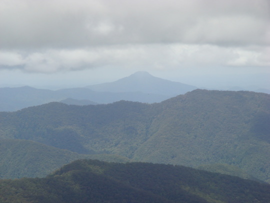
There are Permian granite intrusions at Smoky Cape, Five Day Creek, Dyke River and Georges Junction. A basalt flow from the extinct Ebor Volcano 20 million years ago runs along the New England Tableland and forms a cap on Mt Anderson Sugarloaf. The eastern side of the volcano has been eroded away and only the radial creek patterns remain to show its existence.
The age and extent of coastal barrier formation reflects sea level rise from the past to present. Around 125 000 years ago the sea level was 5m higher than it is now and much of the coast was under water. The last glacial period between 25,000 and 15,000 years ago saw sea levels drop around 110-130 m below their present level as available water was trapped as ice. After this, sea levels rose rapidly and reached the present level around 6,500 years ago. Sea levels have remained within 1 to 2 m of their present levels since this time. Progressive siltation then creates the coastal zone with its various river deltas as we know it today.
Slideshare Geology in the Macleay Valley
Geotours of the Mid North Coast
75-50 million years ago New Zealand and Lord Howe separated from the coast of New South Wales as the Tasman Sea formed. This created the coast of what is now New South Wales. Before this rivers flowed westward into the Great Artesian Basin. However when the new continental edge was formed it warped down to the coast, reversing the major rivers and creating the Great Divide. The erosion created by these rivers formed the Great Escarpment and the debris the alluvial plains of coastal areas of NSW. As the rivers cut down and back into the escarpment and widen their valleys the escarpment gradually moves west. This can be seen today with the erosion at the cliff faces of the escarpment and waterfalls such as Dangar, Apsley and Wollomombi.
The main rock type of the Macleay valley is Permian mudstone, lithic sandstone, conglomerate and shale formed 300-250 Million years ago when Australia was part of the giant supercontinent Pangea. There is also Permian limestone in the Willi Willi area formed from the coral of shallow seas. At Racecourse Head, Delicate Nobby, Big Hill and Point Plomer there is older Devonian (370-415 million years old) siltstone, sandstone, conglomerates and basaltic breccia.
There are Permian granite intrusions at Smoky Cape, Five Day Creek, Dyke River and Georges Junction. A basalt flow from the extinct Ebor Volcano 20 million years ago runs along the New England Tableland and forms a cap on Mt Anderson Sugarloaf. The eastern side of the volcano has been eroded away and only the radial creek patterns remain to show its existence.
The age and extent of coastal barrier formation reflects sea level rise from the past to present. Around 125 000 years ago the sea level was 5m higher than it is now and much of the coast was under water. The last glacial period between 25,000 and 15,000 years ago saw sea levels drop around 110-130 m below their present level as available water was trapped as ice. After this, sea levels rose rapidly and reached the present level around 6,500 years ago. Sea levels have remained within 1 to 2 m of their present levels since this time. Progressive siltation then creates the coastal zone with its various river deltas as we know it today.
Slideshare Geology in the Macleay Valley
Geotours of the Mid North Coast